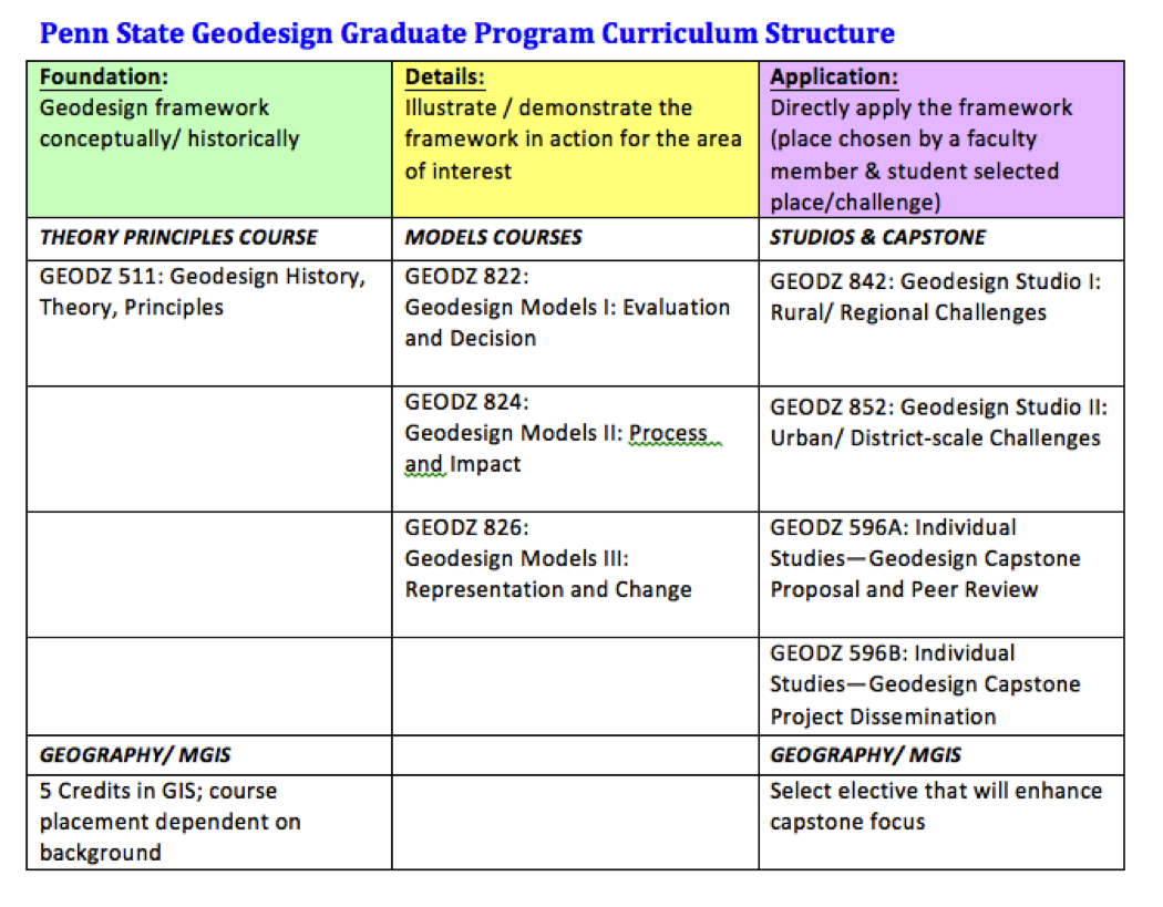
We’ve designed Penn State’s geodesign curriculum to help you acquire key skills to take the lead on complex environmental design problems -- those that require the synthesis of geographic knowledge, geospatial analysis, and best practices of design. Our unique combination of geodesign and geography courses, will enable you to harness the power of design- and science-based analysis and solution synthesis to
• ascertain opportunities for managing resources successfully,
• anticipating change, and
• imagining creative alternative futures.
Penn State's Geodesign program is rooted in an established framework that, coupled with enhanced technologies, provides a sound basis for helping communities address their challenges, including knowing the key questions to ask, how to discover which data are most appropriate, and how to assemble the right team of collaborators.
Over the past 30 years Dr. Steinitz(1) has established a framework proven to work well from large projects to regional scales and in diverse circumstances. Graduates will be capable of taking communities through this geodesign process—thus enabling a future based upon the most informed decisions possible.
(1) Steinitz, C., 2012, A Framework for Geodesign, Redlands CA., Esri Press
Here are some links to useful resources about our curriculum.